
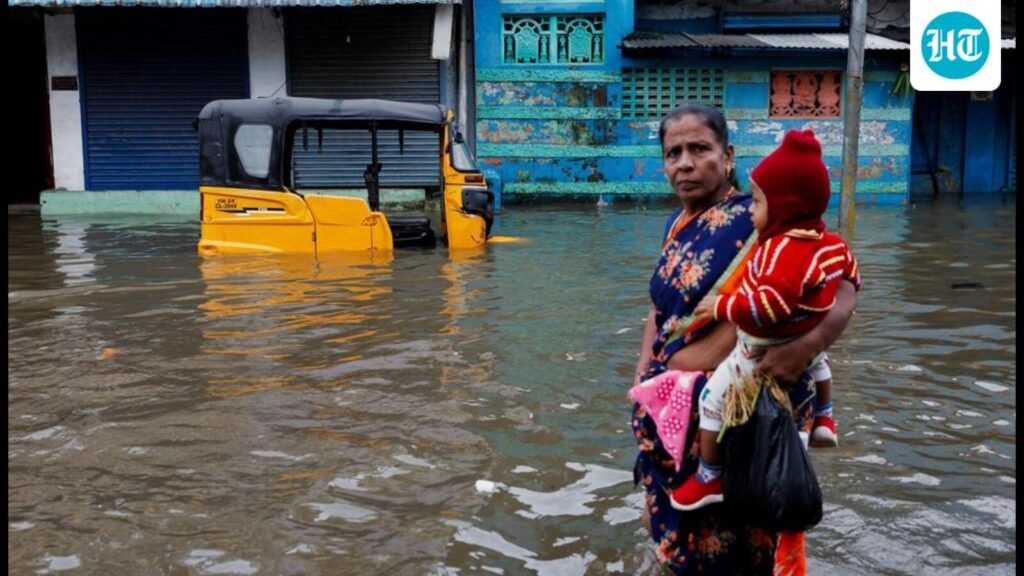
Cyclone warnings reached communities long before Senyar and Ditwah made landfall. Satellites tracked the storms, meteorological agencies issued heavy-rain alerts, and governments moved rescue teams into place. Yet, more than 1,000 people still died across Indonesia, Sri Lanka, Thailand, Malaysia, and India. Most were swept away not by wind but by sudden torrents of water, landslides and flash floods.
")
Neither Senyar nor Ditwah ranked among the strongest storms of recent decades. Their wind speeds (60–80 km/hr) did not approach the ferocity of super cyclones (often reaching 200–250 km/hr), but they carried extraordinary amounts of water. In Sumatra, Senyar’s rains triggered landslides that buried homes and cut off entire districts. Ditwah drenched Sri Lanka, submerging towns, breaching the Mavil Aru dam, and forcing hundreds of thousands into shelters. Both storms acted as triggers — their rainfall cascaded into landslides upstream and flash floods downstream, creating fast-moving, compound hazards that left communities little time to react.
The common thread is that the rainfall disasters occurred in places with hills and rivers, where steep terrain, encroached channels, dense settlement and fragile infrastructure amplify the danger. The cyclone warnings were technically accurate. What failed was the ability to translate a meteorological alert into safety on the ground. In several regions, communities had no time to act even when alerts were received. Rainfall intensified so quickly that slopes failed within minutes, highlighting how traditional warning lead-times are shrinking in a warming climate.
Across much of the region, the most vulnerable live on slopes and floodplains. Hillsides carved for small farms or makeshift housing become unstable after days of saturation. Riverbanks packed with settlements mean the residents are just a few meters away from water that can rise violently within minutes. Forecasts can’t compensate for decades of unplanned growth, weak land-use regulation and absence of safe alternatives.
Meteorological agencies in Indonesia, Sri Lanka, Thailand, Malaysia and India tracked the storms, issued advisories and pre-positioned emergency teams. But the geography of risk is intensely local. A national alert cannot by itself tell a family on a hillside when their slope is about to fail, or evacuate a neighborhood where the only road washes away, or overcome the economic reality that leaving home means losing livestock, wages or the small savings many depend on.
The science behind these disasters points to a climate system that is primed for heavier extremes. Warmer oceans store more heat, which fuels stronger rain bands around tropical cyclones, while a warmer atmosphere holds more moisture and releases it in more intense bursts. The ongoing La Niña phase strengthened moisture flows into Southeast Asia and the Bay of Bengal, creating multi-day downpours. Under global warming, the Indo-Pacific warm pool — a large patch of warm ocean from the Bay of Bengal to the western Pacific, where temperatures stay above 28°C and support storms and cyclones — has grown larger and hotter. This “warm pool” puts more moisture into the air, and during La Niña, it gets an extra push, sending even more moisture into this region and into these storms. Even moderate storms can now deliver rainfall that overwhelms drainage, destabilises slopes and breaches rivers and reservoirs.
Higher ocean heat is also prolonging the window for extreme rainfall. Even outside the traditional cyclone or monsoon seasons, the atmosphere now holds enough moisture to trigger severe downpours when any disturbance passes through.
To understand why so many lives were lost, it helps to think not just in terms of hazard but in terms of exposure and vulnerability. The hazard, a cyclone that delivers extreme rain, was well forecast, but the exposure of people living in landslide-prone terrain and on floodplains, and the vulnerability created by limited warning-to-evacuation capacity, fragile housing, poor drainage and lack of risk-informed planning meant that a forecast alone could not prevent tragedy.
This last mile is the weakest link in South Asia’s disaster preparedness. Inland flooding, landslides and compound events — multiple hazards arriving together — remain far harder to manage than coastal storm surges. Many local governments lack up-to-date landslide maps, flood-inundation models or clear protocols for emergency evacuation. In many rural and peri-urban areas, people have no safe shelters within reach, no transport during an emergency and no way to receive real-time instructions once communications fail. The result is that communities are forced to cope on their own, often reaching the soft limits of what local adaptation can achieve without stronger institutional support.
The solution is not simply “more warnings”. It is better planning, stronger local governance and development that recognizes climate risk as a central organizing principle. That means mapping dangerous slopes and restricting construction there, and investing in drainage, river-embankment strengthening and slope-stabilization projects. It means designing reachable, trusted shelters, with drills in schools and communities and early-action plans that activate long before water rises or hills begin to move.
These storms should shift the regional conversation. South Asia and Southeast Asia face a new class of disasters — storms that may not be the strongest by wind speed but are supercharged for rain in a warmer ocean. The infrastructure of the last century cannot meet the extremes of this one.
Senyar and Ditwah revealed something uncomfortable yet undeniable. Science has moved ahead, the satellites see more than ever, and the forecasts reach further. But, unless homes, roads, schools, farms and local institutions adapt at the same pace, warnings will remain as weather reports — signals that arrive on time, yet still too late.
Roxy Mathew Koll is a climate scientist at the Indian Institute of Tropical Meteorology and a lead author and reviewer of recent IPCC reports. The views expressed are personal